Satellite Crew Tracking, Turnout Gear Built for Women, and Wildfire Digital Twins
Issue 020 - July 7, 2026
Read time: 8 minutes
This week: two Colorado brothers built a satellite tracker that puts every wildland crew on one map when the cell signal dies, a Danish gear maker finally engineered turnout gear around the female body instead of shrinking men's cuts, and Google.org put $1.8M into building digital twins of wildfire-prone forests. Plus a USFA study puts a number on behavioral health struggles, FireSat gets $26M to build a wildfire-watching satellite constellation, and Cleveland wires 36 rigs to warn Waze and Apple Maps drivers before they hear the siren.
 Comms / Wildfire
Two Colorado Brothers Built a Satellite Tracker That Puts Every Wildland Crew on One Map
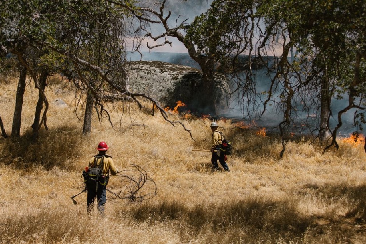
On June 30, 2026 - the 13th anniversary of the Yarnell Hill Fire that killed 19 Granite Mountain Hotshots - RoGO Communications of Lakewood, Colorado launched DropBlock 2.0, a satellite-linked device that tracks the GPS location of firefighters and equipment in places with no cell service. The company was founded by CEO Rod Goossen and his brother Derek, a training and safety captain at Red, White and Blue Fire Protection District, after the Yarnell tragedy exposed how little incident command knew about where crews actually were. The Granite Mountain crew had paper maps, compasses, and two-way radios. That was it.
DropBlock transmits over the Iridium satellite constellation at a lower frequency than Starlink, which lets the signal punch through tree canopy where other systems fail. The new version is smaller and lighter so a wildland firefighter can carry it, runs on eight AA batteries inside an IP67 weatherproof case, and pairs to a phone app that shows crew locations, point-to-point text messages, and fire weather data on one common map. Hand crews, engines, dozers, water tenders, medevac sites, and high-value structures all show up as tracked assets.
The first DropBlock has already seen field use with the Arizona Department of Forestry and Fire Management, and RoGO began testing 2.0 at Red, White and Blue in Breckenridge. Wildfire division chief Matthew Benedict framed the value in plain terms: accountability and finding your people is a core part of fire management, and in vast wilderness you do not always have eyes on them. A hard commercial launch is targeted for September.
The take: Every after-action report on a wildland fatality circles back to the same gap: command did not know exactly where the crew was when conditions turned. This is a purpose-built answer to that gap from people who lived it. The question for chiefs is not whether crew-location tech is coming - it is whether you adopt it before your own close call or after.
Read the full story at CBS News Colorado →
 PPE / Innovation
Turnout Gear Designed Around the Female Body, Not a Shrunk-Down Man's Cut
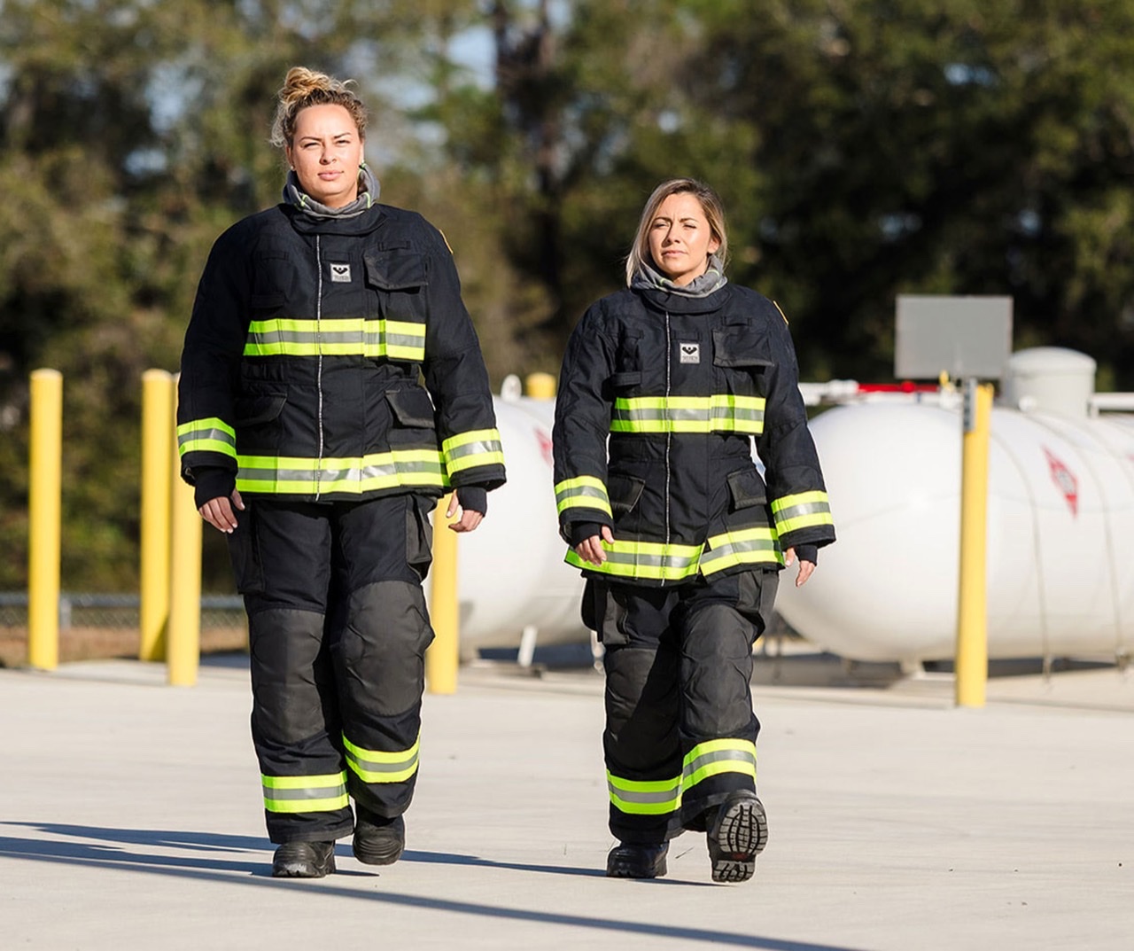
For decades the standard fix for a woman on the job has been men's turnout gear with a few alterations. VIKING Fire and Rescue threw that approach out and built the VIKING VALKYRIE from scratch around the female form, starting with anatomical studies of women in the United States that mapped how body proportions shift across sizes and body types. Chief designer Camilla Callesen says the work started at the most fundamental level of how a garment is constructed - the pattern and the grading, meaning how the gear changes shape across sizes rather than just scaling a men's cut up or down.
The point is not comfort for its own sake. Mobility is safety. You cannot clear a windowsill on vent-enter-search, advance a hoseline, or throw ground ladders efficiently if your gear rides up, bunches, or forces you to fight the fabric on every movement. VIKING designed the VALKYRIE to support climbing, crawling, and lifting without restriction or pressure points, and ran targeted field trials in Oklahoma to verify it on working firefighters.
The most telling part of the story is what the testers said. Firefighter Kendall Taylor admitted the crews did not even know what better gear could feel like because they had spent entire careers in bulky hand-me-downs. Chief Onie Welsh, who is 110 pounds and had worn oversized gear for years on a volunteer department, described burning energy just fighting the extra material to reach the hose or step up into the rig. They did not know what they did not know.
The take: Women are the fastest-growing segment of the American fire service and most of them are still issued gear designed for someone else's body. This is not a diversity checkbox - it is a fireground performance and injury problem hiding in plain sight. Every chief signing a PPE contract should be asking the manufacturer how the women's gear is patterned, not whether it comes in smaller sizes.
Read the full story at Fire Engineering →
 Wildfire / Research
Google.org Puts $1.8 Million Into Building Digital Twins of Wildfire-Prone Forests
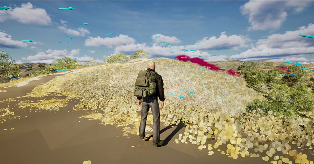
Google.org announced a $1.8 million grant on July 6, 2026 to UC San Diego's Societal Computing and Innovation Lab (SCIL) to accelerate its Wildfire Science and Technology Commons, a shared platform where researchers, technologists, and fire practitioners build and test wildfire tools together. The funding backs SCIL's push to create digital twins of real forests - virtual landscapes stitched together from hundreds of 360-degree LiDAR scans of actual vegetation and surface fuels - that let agencies simulate fire behavior before conditions ever turn dangerous.
The work builds on more than a decade of SCIL fire-modeling research already used in initial attack planning and prescribed-burn strategy. In March, the lab convened more than 30 members of the Wildfire Commons community at Google headquarters to identify the highest-value use cases for digital twins across the full wildfire lifecycle, from pre-season risk reduction to active incident response and post-fire recovery. Participants flagged fragmented data systems and limited model interoperability as the biggest barriers standing between today's research and tools chiefs can actually use.
SCIL Director Ilkay Altintas said the goal is a federated, open digital-twin framework built on existing systems rather than a rebuild from scratch - infrastructure that connects fuels, topography, and weather data, stays accessible to the fire management community, and can scale beyond a single research lab. A new digital-twin case study community formed out of the workshop will meet quarterly to steer that build-out.
The take: This is university and philanthropic money, not a vendor pitch, which means the tools that come out of it are likelier to end up open and shared across agencies instead of locked behind one company's license. Departments in wildfire-prone regions should watch the Wildfire Commons directly - this is where the pre-incident planning tools of 2028 are being built right now, in public.
Read the full story at UC San Diego SDSC →
 Behavioral Health
USFA Study Finds 40 Percent of Fire and EMS Personnel Struggling With Behavioral Health
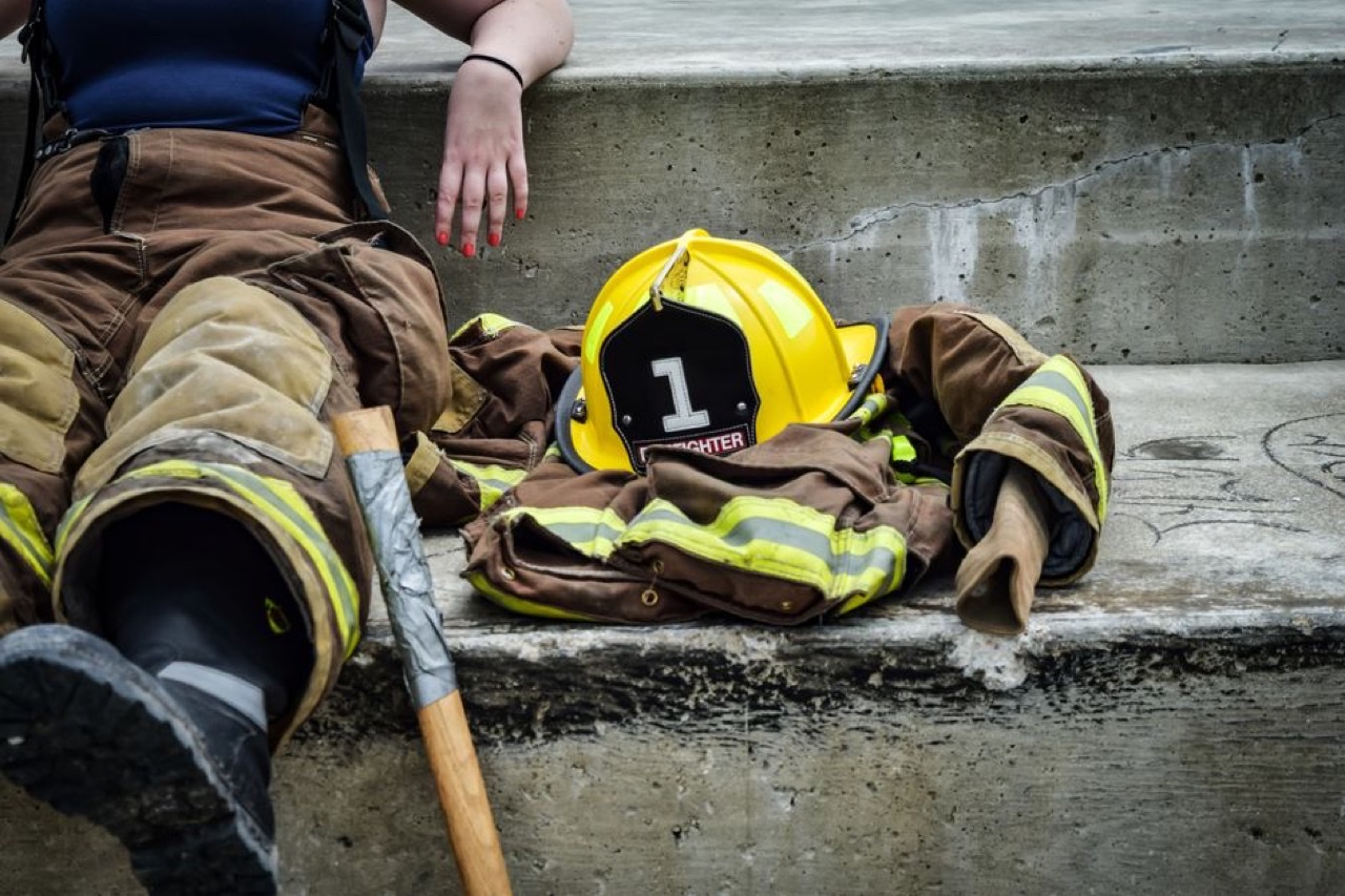
The U.S. Fire Administration released a national behavioral health study on June 26, 2026, documenting that nearly 40 percent of fire and EMS personnel are perceived by their peers as struggling with mental health issues. Rates of post-traumatic stress injury and depression are significantly higher among fire and EMS responders than in the general population. The study found that confidentiality concerns, limited access to care, and fear of professional repercussions remain the primary barriers to help-seeking, even as stigma is slowly decreasing.
Key findings: departments with peer support teams report measurably higher levels of emotional support and greater awareness of available resources. Special attention in the study was flagged for women, minorities, and EMS personnel, who report feeling less supported than career firefighters. The study recommends regular behavioral health screenings, access to vetted providers with first responder experience, open communication policies, and family support programs.
The study arrives as the fire service is mid-season through what is shaping up to be one of the most demanding wildfire summers in years, with 50+ large fires burning nationally and federal crews already reporting burnout levels that typically appear in August.
The take: Forty percent is not a rounding error. This is a USFA-published baseline that department chiefs can take to their city councils and union negotiations when asking for peer support funding. The buried finding - that EMS personnel feel less supported than firefighters within combined departments - has specific staffing and retention implications.
Read the full story at USFA →
 Wildfire / Technology
Bezos Earth Fund Puts $26 Million Into FireSat Wildfire Satellite Constellation for Global Coverage
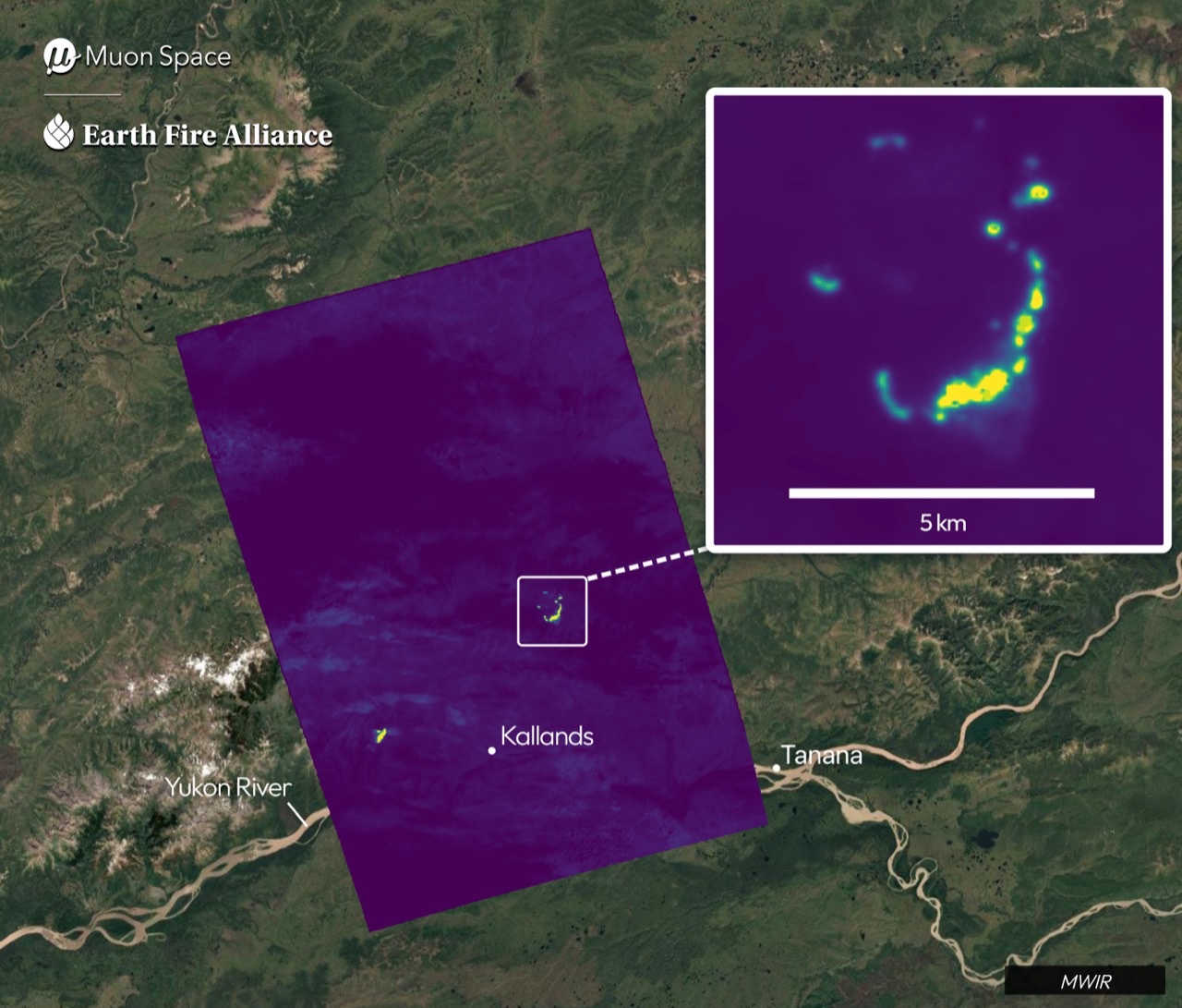
The Bezos Earth Fund announced a $26 million investment on June 17, 2026, in Earth Fire Alliance's FireSat program - the first satellite constellation purpose-built specifically for wildfire detection. Three operational FireSat satellites are set to reach orbit in Q3 2026, adding to a prototype already imaging active fires in South America. The total funding coalition now stands at $69.2 million, including $15.5 million from Google.org and $12.5 million from the Gordon and Betty Moore Foundation.
FireSat satellites, built by Muon Space and operating with AI models from Google Research, are designed to detect fires as small as 15 feet by 15 feet within one hour of ignition. Once the full constellation of approximately 50 satellites is operational in the early 2030s, every point on Earth will be monitored every 20 minutes. Current weather and earth observation satellites can only detect fires the size of a cruise ship; FireSat's multi-wavelength sensors can see through smoke and identify low-intensity burns.
The practical implication for U.S. fire agencies is timeline: the initial three satellites launching this summer focus on the Amazon Basin. The coverage expansion toward North American wildfire zones is a 2027-2030 roadmap item. But the detection architecture - sub-15-minute alert from ignition to incident command notification - is the model that will eventually replace ground-based camera networks.
The take: FireSat is the satellite equivalent of moving from hand tools to a thermal drone - it changes the detection timeline, not just the resolution. Chiefs evaluating wildfire early warning investments should understand where FireSat fits in the 2027-2030 horizon vs. what they need for this season.
Read the full story at Globe Newswire →
 Technology / Apparatus
Cleveland Installs Safety Cloud on 36 Fire Trucks to Alert Waze and Apple Maps Drivers
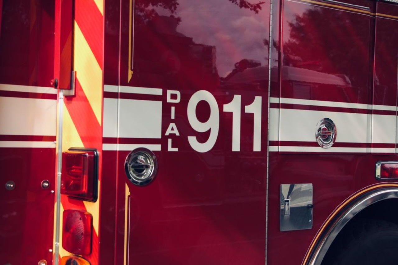
The Cleveland Fire Department is equipping all 36 of its fire apparatus with the Safety Cloud system, which sends real-time alerts to drivers via Waze and Apple Maps the moment a truck activates its emergency lights and sirens. The alert appears on the driver's navigation screen before they can hear the sirens - closing the gap created by distracted driving, high-volume music, and in-vehicle noise. GovTech reported the rollout in June 2026; roughly 25 percent of vehicles were equipped at the time of publication.
Cleveland is one of 4,000 public safety agencies nationwide currently using Safety Cloud. The system integrates natively with Apple Maps and Waze but not yet with Google Maps directly. Alerts disappear automatically within minutes after the truck's emergency systems are turned off. Officials say the technology will eventually expand to police and ambulances in the city.
The practical value for command officers: response corridor clearance is a consistent factor in time-to-arrival for the most critical calls. At roughly $11,000 per vehicle and without requiring any driver app download or opt-in beyond using major navigation software, Safety Cloud's cost-per-clearance math is considerably more favorable than driver education campaigns alone.
The take: Four thousand agencies nationwide means this is not experimental - it is an operational product with a clear procurement path. The question for departments not yet using it is straightforward: if distracted driving kills firefighters and patients on the response corridor, and a $11K-per-truck solution already works, what is the procurement hold-up?
Read the full story at GovTech →
What We're Watching
- Low-Earth-orbit satellite messaging moving from wildland crew tracking toward structural and rural mutual-aid accountability as constellations like Iridium and direct-to-cell services expand coverage
- Whether NFPA turnout gear standards start specifying female-anatomy pattern grading rather than size range, now that purpose-designed women's gear exists on the market
- Senate Judiciary markup schedule for the Protecting Firefighters and Advancing State-of-the-Art (PFAS) Alternatives Act - timeline matters for the 2028-2030 turnout gear procurement cycle
Get The Overhaul Brief in your inbox
Fire service tech, AI, and innovation - delivered every Tuesday morning.
Subscribe